
The Perfect 3-Day Trip to John Day Fossil Beds
A complete weekend itinerary covering all three units of John Day Fossil Beds National Monument: Sheep Rock, Painted Hills, and Clarno. Where to stay, where to eat, what to see, and how to make the most of three days in Eastern Oregon’s prehistoric wonderland.
3-Day Trip Quick Stats
The John Day Fossil Beds National Monument is a colorful wonderland that simultaneously feels like you have stepped back 30 million years and like you have somehow landed on Mars. The colors of the painted mounds shift with the light. The fossils tell a 45-million-year story of the Cenozoic Era, with prehistoric alligators, hippopotamuses, sabertooth tigers, and four-toed horses all once roaming the same hills. And it is one of the best-kept secrets in the National Park system: 13,944 acres, free entry year-round, and rarely crowded outside summer weekends.
The catch is that the monument is split into three separate units that are 45 to 81 miles apart on slow rural roads. Doing them justice in a single day is impossible. This 3-day road trip itinerary covers all three units (Sheep Rock, Painted Hills, and Clarno), the Thomas Condon Paleontology Center, a stop at the Shaniko Ghost Town on the way home, and where to eat and sleep in the small towns of Dayville, Mitchell, and John Day. Everything below is verified for 2026, including trail distances, current restaurant hours, and lodging that we have personally stayed at.
45 million years of Cenozoic life, exposed in three places
The John Day River basin is one of the most complete fossil records of the Cenozoic Era (the “Age of Mammals”) anywhere on Earth. Volcanic ash from successive eruptions in the Cascades buried plant and animal remains over and over again, layer after layer, from about 45 million years ago (the late Eocene) through about 5 million years ago (the late Miocene). Erosion has since cut through those layers, exposing the fossil-bearing strata as colorful badlands.
Each of the three units exposes a different period: Clarno preserves the oldest layer (44 million years ago, when the area was a near-tropical jungle with rhino-like brontotheres and four-toed horses). Painted Hills shows the middle layer (33 million years ago, drier and cooling). Sheep Rock reveals the most recent layer (7 to 28 million years ago, when grasslands and modern mammal lineages were emerging). Together, the three units lay out the planet’s climatic and biological story across tens of millions of years.

Things to know before you go
John Day Fossil Beds is genuinely remote. The towns are small, cell service is rare, and there are no gas stations or restaurants inside the monument itself. A bit of advance planning saves a lot of hassle on the road.
- Park entry is free. No fee, no permit, no entrance booth. Trails, overlooks, picnic areas, the Thomas Condon Paleontology Center, and Cant Ranch are all free year-round.
- Cell service is essentially zero inside the monument and limited in surrounding towns. Public Wi-Fi is available only at the Thomas Condon Paleontology Center and the Painted Hills picnic area. Download offline maps in Google Maps or Gaia GPS before you leave.
- No gas, no food, no lodging in the monument. Fill up in Sandy, Prineville, or Madras before driving in. Gas in the area is available at Dayville, Spray, Mitchell, Fossil, and John Day.
- Thomas Condon Paleontology Center hours: 10am to 5pm daily. Closed federal holidays during winter (Veterans Day in November through Presidents’ Day in February). The center has 500+ fossils on display, an 18-minute introductory film, a viewing window into the working paleontology lab, and clean restrooms.
- Travel times are slower than Google says. The roads are winding rural two-lanes; expect to average 45 mph. Highway 218 to the Clarno Unit is particularly curvy; plan on 35 mph there.
- Camping is not allowed inside the monument. Camp at private campgrounds, BLM sites, or stay in nearby towns.
- Collecting fossils is illegal. All fossils, rocks, and natural materials must stay where you find them. The only legal fossil-digging site in Oregon is at Wheeler High School in the town of Fossil; call (541) 763-4146 for hours.
- Summer is hot and exposed. July and August routinely hit 95+°F with no shade on most trails. Bring 2 to 3 liters of water per person per day, plus a wide-brim hat and sunscreen.
A map of your 3-day road trip
Here’s the full driving route mapped out: from Portland to the Sheep Rock Unit, north to Painted Hills, west to Clarno, and back to Portland via Shaniko. Click any pin for details on each stop.
All four stops on the full 3-day loop, with mileage totals between each.
The three units of the monument
The three units of John Day Fossil Beds are not next to each other. Each one is a separate fossil-bearing landscape with its own visitor experience. Here’s the short version of what each offers:
Clarno Unit Fossils & Palisades
Where to stay near John Day Fossil Beds
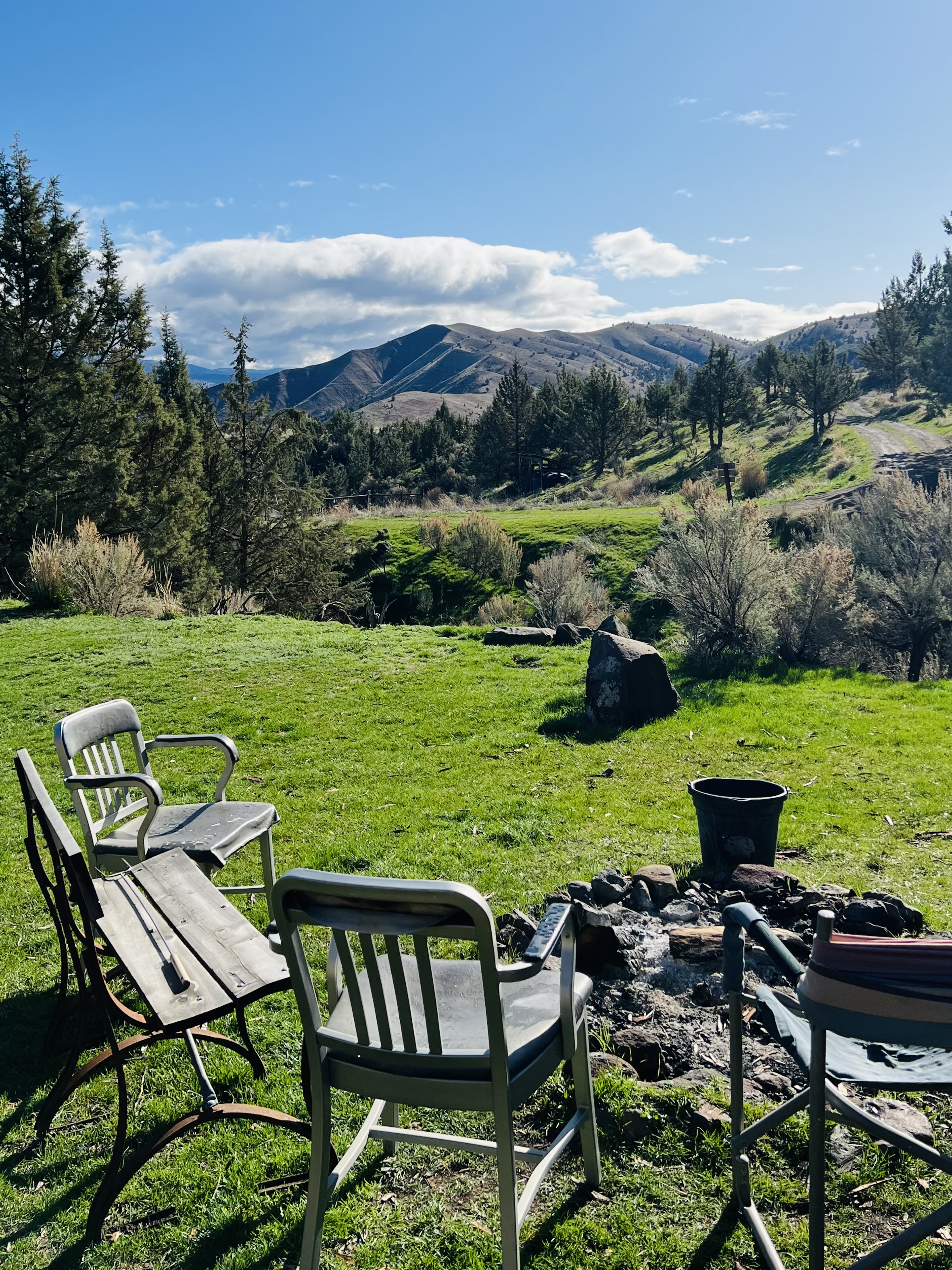
The John Day area is in many ways still the Wild West, and the lodging options reflect that. There are no chain hotels in Dayville or Mitchell, and Airbnb stock is small. Book early in summer. For the most convenient access to all three units, base yourself in Dayville (closest to Sheep Rock), Mitchell (closest to Painted Hills), or John Day (more amenities, slightly farther). Here are options across price points.
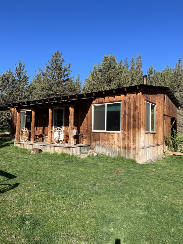
Off-grid cabin and glamping (~$90-$120/night)
Guyon Springs Inn in Dayville (28868 S Fork Road, 541-620-4950) is a 120-acre off-grid farm with one cabin and two wall tents, overlooking the South Fork and John Day River Valleys. Stays include weekend breakfast, plus access to a working farm store with milled cereals, local honey, fresh-cut flowers, garlic braids, and pepper ristras. Guests can explore the property and learn about off-grid living. Pet-friendly. Ask about the “pack a picnic” option. This is part of the John Day River Farm Trail, so it’s an authentic Eastern Oregon experience, not a manicured resort. Cell service is spotty, so plan accordingly.
Family vacation rental (~$220/night)
The Sunset Cottage in Mitchell sleeps up to 15 people across multiple bedrooms, has a private kitchen and bath, high-speed Wi-Fi, and a backyard garden space. It’s a short walk to Mitchell’s main street, where you’ll find Tiger Town Brewing Co., the general store, and the gas station. Excellent for large families or small groups doing the trip together.
Traditional hotel (~$150/night)
The Best Western John Day Inn in John Day is the easy, predictable option: double or king-sized beds, Wi-Fi, a pool, and a hot breakfast included. Closest to John Day’s restaurants and gas, but a longer drive (~30 minutes) to the Sheep Rock visitor center.
Other options worth a look
Airbnb listings in Dayville include the Fish House Inn (a charming 1908 Craftsman home on the Fish House Inn & RV Park grounds in central Dayville, with 3 bedrooms and a private back patio). Airbnbs in Mitchell and John Day add another 10 to 15 properties to choose from. Book early in late spring through fall.
Day 1: Sheep Rock Unit
Day 1 is mostly driving in the morning, then a packed afternoon at the largest of the three units. The Sheep Rock Unit has the visitor center, so you’ll start your trip by getting oriented and seeing 500+ fossils on display before heading out to the trails.
Hit the road from Portland (or Bend / Eugene)
Leave early for the long drive east. From Portland, take US-26 east through Sandy and Prineville. The drive is roughly 240 miles and 4 hours, but budget closer to 5 to stop for photos and to refuel. From Bend, the drive is shorter (122 miles, ~2.5 hours via US-26). From Eugene, take OR-126 east to US-97 to US-26 (~230 miles, 4 hours). Top off your tank in Prineville (from the south) or Sandy (from the north); fuel options after that are limited.
Foree Picnic Area & Flood of Fire Trail
Your first stop in the Sheep Rock Unit is the Foree Picnic Area, a perfect lunch spot with shaded tables and clean restrooms. After eating, walk the Flood of Fire Trail (.4 miles each way), which gives you a quick introduction to the layered geology of the monument and brings you to a ridge with sweeping views over Picture Gorge and the John Day River.
Cathedral Rock photo stop
A 5-minute drive south of Foree. Cathedral Rock is a striking ash-formed rock spire that catches afternoon light beautifully. You’ll be stopped here 10-15 minutes for photos.
Blue Basin trails
Continue 10 minutes to the Blue Basin parking area. From here, you have two trail options:
- Island in Time Trail (1 mile round trip): the easier choice, mostly flat, family-friendly. Walks you into the basin’s surreal blue-green claystone walls. Interpretive signs along the way explain the fossil discoveries from the area.
- Blue Basin Overlook Trail (3 miles loop, ~600 ft elevation gain): a more challenging hike that climbs above the basin for big views down into it and out across the John Day River Valley. Best done counterclockwise. Takes about 1.5 hours.
Most visitors with kids do the Island in Time. Most visitors without kids do the overlook for the better views. If you have time and energy, you can do both back-to-back (~2 hours total).
Cant Ranch & Thomas Condon Paleontology Center
Drive 20 minutes south to the visitor area. Cant Ranch on the left is a preserved 1910 sheep-and-cattle ranch homestead with cultural exhibits about the area’s pioneer history. Thomas Condon Paleontology Center on the right is the main attraction: 500+ fossils on display, an 18-minute introductory film, and a viewing window where you can watch researchers cleaning fossil specimens in the working lab. Plan on at least an hour at each. Both close at 5 PM.
Note: dogs are not allowed inside Cant Ranch House or the Thomas Condon Center.
Picture Gorge photos
A 5-minute drive south of the visitor center. Picture Gorge is a narrow basalt canyon cut by the John Day River, named for the prehistoric pictographs on its walls (visible from a pullout). Late afternoon light gives the basalt walls a warm glow.
Drive to your accommodation
From Picture Gorge it’s about 30 minutes to Dayville, 45 minutes to Mitchell, and 1 hour to John Day. Settle in, eat dinner (grocery options are limited; bring food or eat at one of the local cafes), and rest up for tomorrow.
Day 2: The Painted Hills
Day 2 is the photographer’s day. The Painted Hills are why most people make this trip, and you’ll spend most of the daylight hours exploring the four short trails that make up the unit. Get an early start. The Painted Hills are best in soft morning or late-afternoon light, and the trails have no shade in midday.
Optional breakfast at Dayville Cafe
If you’re staying in Dayville or John Day, stop at Dayville Cafe (212 W Franklin Ave, 541-987-2122). Greg Van Tassel runs the kitchen and makes homemade pies (over 40 varieties) along with hearty breakfasts: chicken-fried steak, the Dayville Platter, eggs Benedict, and a particularly good house-made sausage breakfast sandwich. Open Wednesday through Sunday, 7am to 4pm. Closed Monday and Tuesday; plan around that.
Mascall Formation Overlook
A quick 300-foot walk to a viewpoint with interpretive signs explaining the Mascall Formation, a 15-million-year-old layer that’s particularly rich in fossils. Worth the 10-minute stop, and a good warmup for the day.
The Painted Hills (4 trails)
Drive to the Painted Hills Unit (1 hour from John Day, 15 minutes from Mitchell). The unit has four short trails that together cover the best of the painted mounds. Plan on 3 to 4 hours total to do all four:
- Painted Hills Overlook (.5 miles round trip): the iconic out-and-back trail to the postcard view. The main parking lot puts you within 5 minutes of the overlook.
- Carroll Rim Trail (1.6 miles round trip, ~400 ft elevation): climbs the ridge above the Painted Hills for panoramic views of the mounds, Sutton Mountain, and the surrounding canyons. Steep but rewarding.
- Painted Cove Trail (.25 miles loop): a wooden boardwalk that takes you up close to the colored mounds. Best trail for understanding the layered structure of the formation.
- Red Hill Trail (.25 miles round trip): a short walk to a multicolored knoll that gives you a different angle on the painted formations.
Bring lots of water, a hat, and sunscreen. The Painted Hills have no shade and the surrounding rock can hit 110°F in summer. There’s a picnic area with public Wi-Fi and restrooms at the entrance.
Lunch at Tiger Town Brewing Co.
Drive 15 minutes east to Mitchell for late lunch at Tiger Town Brewing Co. (formerly Tiger Town Pub, phone 541-462-3663, open 11am-9pm). Mitchell is a tiny town with one main intersection, but Tiger Town is the kind of place that would do well in Portland: house-made beer, a creative menu (gyro, Greek nachos, fish and chips, burgers and flat fries), and friendly staff. Outdoor seating is the move when weather allows.
Optional: Explore John Day
If you have energy, drive to John Day to see the Kam Wah Chung Museum (a preserved 1880s-era Chinese herbalist shop and general store, listed on the National Register of Historic Places), browse the small downtown, and pick up groceries. Otherwise, head back to your accommodation, get an early dinner, and rest for tomorrow’s longer drive.
Day 3: Clarno Unit & Shaniko Ghost Town
Day 3 takes you to the smallest and farthest-west of the three units, then onto a unique piece of Oregon history on the way back to Portland. The Clarno Unit is often the most-skipped unit because it’s the farthest from anything, but it’s the only place in the monument where you can see fossils in their original rocks at the trail.
Drive to the Clarno Unit
The drive is 1 to 1.5 hours from your accommodation. Highway 218 to the Clarno Unit is winding and scenic; expect to drive 35 mph and budget a slower travel time than Google Maps suggests. The route follows the John Day River through dramatic canyons and high-desert sagebrush. Few cars, lots of light, beautiful early-morning conditions for photos.
Three short Clarno trails (1 mile total)
The Clarno Unit has three trails, all starting from the same parking area. They’re short and you can do all three in 1.5 to 2 hours:
- Geologic Time Trail (¼ mile each way): climbs about 200 feet in elevation and brings visitors directly under a natural arch cut into the cliff by erosion. Petrified logs are visible in the cliff face.
- Trail of Fossils (¼ mile loop): the only trail in the entire national monument where visitors can readily see fossils embedded in the rocks. Large boulders strewn below the Palisades contain dozens of visible plant fossils from the near-tropical forest that blanketed the region 44 million years ago.
- Arch Trail (¼ mile each way): takes you to a natural arch eroded into the volcanic palisade. Less dramatic than the Geologic Time Trail’s arch but worth the short walk.
Picnic outside the Clarno Unit
There’s a small picnic area at the parking lot. Pack your lunch from the morning at your accommodation and eat in the shade of the towering Clarno Palisades. From here, it’s a 35-minute drive northwest to Shaniko.
Shaniko Ghost Town
Once Oregon’s largest wool-shipping town in the early 1900s, Shaniko is now a town of roughly 30 residents and a collection of preserved historic buildings. Walk the main street to see the 1900 Shaniko Hotel, the working blacksmith shop, the old jail, and various wagon and equipment displays. Many of the businesses operate seasonally; weekends in summer are when the most are open. Plan on 30 to 45 minutes here. It feels exactly like stepping back in time, and is a great photo stop for the kids.
Drive back to Portland
From Shaniko, it’s about 2.5 hours back to the Portland area via US-97 north and I-84 west. From Bend, the drive home is about 1.5 hours via US-97 south. Plan stops in Maupin (Deschutes River views) or The Dalles (Columbia Gorge) if you want to extend the road trip a bit further.
Total drive time across the 3 days: approximately 11 hours. Total mileage from Portland: about 600 miles. The pace described above leaves time at the end of each day to relax at your accommodation; if you’re more ambitious you can pack in additional side hikes or an extra ghost town.
Best time to visit John Day Fossil Beds
The monument is open year-round, but the experience is dramatically different between seasons. Here’s how to time your trip:
| Season | What to expect | Pros & cons |
|---|---|---|
| Spring (Apr-May) | Wildflowers across the Painted Hills, mild 60s-70s temperatures, occasional rain. Trails are dry and clear by mid-April. | |
| Early summer (Jun) | Warm to hot 70s-90s, longer daylight, no wildflowers. Good photography light at sunrise and sunset. | |
| High summer (Jul-Aug) | 95+°F regularly, no shade on most trails, dry, hazy from wildfires. Painted Hills colors are most muted in midday sun. | |
| Fall (Sep-Oct) | Cool clear weather (50s-70s), golden light, fewer crowds, fall colors in the cottonwoods along the John Day River. | |
| Winter (Nov-Mar) | Cold (20s-50s), occasional snow, TC Center closed federal holidays. Painted Hills trails are open but exposed and windy. |
The cleanest single answer: aim for late April through early June, or September through mid-October. Painted Hills wildflowers peak in May. The best photography light any time of year is the first hour after sunrise and the last hour before sunset.
What to pack for John Day
The high desert climate means real preparation matters here. Sunburn, dehydration, and a dead phone (no cell service to navigate with) are the three most common ways trips go wrong. Pack accordingly:
Bringing your dog
The John Day area is dog-friendly overall, but with one specific gotcha worth knowing about. Leashed dogs are allowed on most trails and at all picnic areas across the three units. Dogs are not allowed inside the Thomas Condon Paleontology Center or the Cant Ranch House.
The Blue Basin trails have metal-grate footbridges. The grates are spaced widely enough that dogs’ paws can slip through, and the metal gets very hot in summer. Consider bringing dog booties for these crossings, or be prepared to carry small dogs across. The grates don’t bother every dog, but they’re an obvious problem for some, and the bridges come up several times along the Island in Time and Blue Basin Overlook trails.
Beyond the grates, the rest of the monument is straightforward dog territory: shade is limited, so plan for water and rest stops, and avoid hiking with dogs in the heat of midday in summer (the rocks reach surface temperatures of 130+°F, which can burn paw pads).
More Eastern Oregon trip ideas
If you’ve got more time, or if this trip whets your appetite for Eastern Oregon, here are a few natural follow-ups:
Frequently asked questions
Is there an entrance fee at John Day Fossil Beds National Monument?
How long does it take to see all three units of John Day Fossil Beds?
How far is John Day Fossil Beds from Portland?
Is there cell service at John Day Fossil Beds?
Where should I stay near John Day Fossil Beds?
Is John Day Fossil Beds dog-friendly?
When is the best time to visit John Day Fossil Beds?
Can you camp inside John Day Fossil Beds?
Can you collect fossils at John Day Fossil Beds?
What is there to do at the Painted Hills?
How long is the Blue Basin trail?
What are the hours of the Thomas Condon Paleontology Center?
What should I pack for John Day Fossil Beds?
Is Shaniko Ghost Town worth visiting?
Last updated: May 2026 · Trail distances, restaurant hours, and lodging availability change. Verify the latest at the National Park Service’s John Day page before you go. The Thomas Condon Paleontology Center information is verified against the official NPS site as of May 2026. AllTrails and the official NPS site are the best sources for current trail conditions and any temporary closures.