Oregon Guide – History
History of the Oregon Trail
From ancient Indigenous footpaths to the Great Migration of 1843, 2,000 miles of prairie, river, and mountain, and the permanent transformation of the Pacific Northwest.
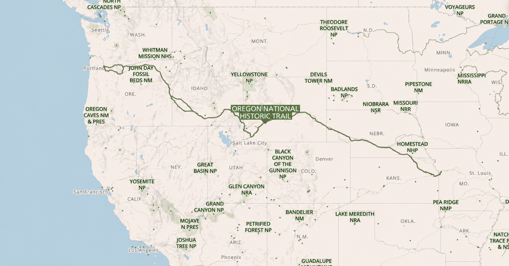
The Oregon Trail was a 2,000-mile overland emigrant route linking the Missouri River to Oregon’s Willamette Valley, used by an estimated 300,000 to 500,000 people between 1840 and 1869. It was not a single road but a broad corridor of wheel ruts, cutoffs, and river crossings that followed ancient Indigenous travel networks across six present-day states. Before it was an emigrant highway it was a fur-trade trace; before that, it was the pathway network of dozens of Indigenous nations whose knowledge made the route possible. This page covers the trail’s full arc: its pre-emigrant origins, the nations whose homelands it crossed, the mass migrations of the 1840s and 1850s, the dangers and daily realities of the journey, the federal policies that drove settlement, what emigrants found when they arrived, and where you can still walk the ruts today.
⚡ Key points
- The Oregon Trail ran 2,170 miles from Independence, Missouri to Oregon City, Oregon, a 4–6 month journey on foot and wagon that an estimated 300,000–500,000 people made between 1840 and 1869.
- The trail followed ancient Indigenous trade routes. The Willamette Valley appeared “empty” to arriving settlers only because an 1830 epidemic had killed 80–95% of its Indigenous population in the decade before emigration began.
- The 1843 Great Migration (875 people, 100 wagons) proved large-scale family crossing was feasible. A Cayuse headman named Ixtíxec guided the wagons through the Blue Mountains after Marcus Whitman was called away, a contribution popular history rarely mentions.
- Disease killed far more travelers than Native attacks: an estimated 30,000 emigrants died of cholera and illness; John D. Unruh Jr.’s count of every recorded conflict death across the full 1840–1860 period totals 362.
- James K. Polk won the 1844 election on “Fifty-Four Forty or Fight”, demanding all of the Oregon Country. The 1846 Oregon Treaty settled the border at the 49th parallel instead, giving the U.S. the Columbia River corridor and Puget Sound.
- The 1850 Donation Land Claim Act transferred 2.5 million acres to qualifying settlers in 7,437 patents, the largest single federal land-grant program to that point in U.S. history.
- The emigrant era effectively ended with the transcontinental railroad in 1869. About 300 miles of original wagon ruts remain visible today, deepest at Guernsey, Wyoming, where wheels cut 5 feet into sandstone.
01 Indigenous Roots & the Fur Trade #
The trail existed long before any wagon crossed it.
The Oregon Trail was not invented by American settlers. Long before covered wagons crossed the plains, the corridor followed ancient Indigenous footpaths, trade routes, and riverine travel systems that linked the Great Plains, the Rocky Mountains, the Columbia Basin, and the Pacific Northwest. The Willamette Valley and lower Columbia River country were densely inhabited, with long-established villages, fisheries, trade networks, and seasonal rounds connecting peoples across the entire region. National Park Service scholarship is explicit: the route’s geographic logic was Indigenous before it was American.
Early Euro-American knowledge of the region came through two overlapping frameworks. The Convention of 1818 established joint U.S.-British occupation of the Oregon Country, the disputed territory covering present-day Oregon, Washington, Idaho, and parts of Montana and Wyoming, a provisional arrangement that lasted until the 1846 Oregon Treaty fixed the border at the 49th parallel. At the same time, Walla Walla and Cayuse leaders permitted the North West Company to establish Fort Nez Perces at Walúula in 1818. After the 1821 HBC merger, this became Fort Walla Walla, an early node in the fur-trade corporate infrastructure that would anchor the route for decades before any emigrant family appeared.
Lewis and Clark’s 1805–1806 journals recorded topography, river conditions, and populous Indigenous villages along the Columbia system, making the region legible to U.S. policymakers. But they did not create the route. The route already existed.
Key moment, 1812
Robert Stuart identifies South Pass
Robert Stuart’s eastbound crossing of South Pass in 1812 demonstrated a comparatively low-elevation route across the Continental Divide, a broad, almost imperceptible saddle in the Rockies that freight wagons could actually traverse. Fur brigades then beat a track along the Platte and through South Pass in the 1820s and 1830s, carrying supplies from St. Louis to the annual Green River rendezvous and returning with beaver pelts. That “fur trace” was the direct ancestor of the Oregon Trail.
02 Indigenous Nations #
The trail crossed dozens of homelands, and transformed every one of them.
The Oregon Trail crossed Indigenous homelands at every mile of its 2,000-mile route. In the Pacific Northwest and Columbia corridor, key nations included the Cayuse, Walla Walla, Umatilla, Wasco, and many Chinookan and Kalapuyan communities. Farther east, the corridor intersected the homelands of the Shoshone, Bannock, Pawnee, Sioux, and other plains nations. Recent NPS scholarship is explicit: fur traders, missionaries, and settlers depended on Indigenous geographic knowledge, labor, and trade for food, safe passage, river crossings, and portage. The trail depended significantly on Indigenous geographic knowledge, trade networks, and labor, even as it ultimately disrupted Indigenous life and displaced many of those communities.
When emigrants arrived and described the Willamette Valley as an “empty Eden ripe for the plow,” they were wrong about the emptiness, and the causes of it matter. In 1830, a disease believed to be malaria reached Fort Vancouver aboard a Pacific trading ship and spread rapidly through the lower Columbia and up the Willamette Valley. Over five years it rampaged through Indigenous communities, bringing fevers, sweats, and bone-rattling chills. Before the epidemic, the Chinookan-speaking peoples of the lower Columbia and the Kalapuyan-speaking peoples of the Willamette Valley together numbered more than 32,000. When it was over, only about 2,100 survived, a loss of 80 to 95 percent. Communities were destroyed. Survivors were too few and too weakened to resist what followed. The valley that emigrants praised as apparently uninhabited had been a densely populated, actively managed landscape less than a decade before the first wagon arrived.
1840s, Early period
Cooperation dominated the first decade
In the first decade of large-scale Oregon Trail travel, NPS materials describe interactions as generally cooperative. Indigenous communities sold meat, guided travelers, assisted with river crossings, and helped locate lost livestock. Elizabeth Dixon Smith recorded Indigenous ferrymen being paid in shirts to transport women and children across the Deschutes. The entire trail infrastructure depended on these services. Without Indigenous knowledge and trade, the emigrant corridor could not have functioned.
1849 onward, Erosion
Cooperation grew strained as migration numbers increased
After 1849, the ecological and social disruption became impossible to ignore. Livestock trampled native plants, wagon concentrations overgrazed grasslands, emigrants consumed game and resources on which local communities depended, and bison slaughter intensified on the plains. Epidemic disease, especially measles, moved through Indigenous communities with devastating speed. By the 1850s, tensions were compounded by local wars and the fact that settlers were claiming land where Indigenous peoples already lived.
November 1847, The Whitman Massacre & the Cayuse Five
The event that ended the missionary era and triggered the Cayuse War
In November 1847, Cayuse warriors attacked the Whitman Mission near present-day Walla Walla, Washington, killing Marcus and Narcissa Whitman and eleven others. The Cayuse’s motivations included years of accumulated tension: the mission had become a stopover for emigrants, a measles epidemic was killing Cayuse in large numbers while many white patients survived, and growing American settlement threatened Cayuse lands. Ixtíxec (“Stickus”), the Cayuse headman who had guided the 1843 wagon train through the Blue Mountains, warned Whitman of the danger twice the day before the attack.
The attack triggered the Cayuse War and led directly to Congress organizing Oregon as a U.S. Territory in August 1848. Five Cayuse men were tried and hanged in Oregon City in 1850. The four surviving Sager sisters, orphaned for the second time, were placed with different families and lived long lives in Oregon, Washington, and California.
03 Missionaries & the First Family Wagons #
From trappers to families, the fur route becomes a migration precedent.
The transition from fur-trade route to emigrant highway required a proof of concept: could families, not just trapper brigades, make the journey? Missionaries provided the first evidence that they could. Their motives combined genuine religious belief with boosterism: their letters home describing Oregon’s fertile lands and spiritual opportunities reached thousands of readers in the East and Midwest and helped build the case for mass migration.
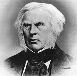
Marcus & Narcissa Whitman
Narcissa Whitman and Eliza Spalding became the first Euro-American women to cross the Rocky Mountains on what would become the Oregon Trail, traveling west with a fur brigade in 1836. Their journey transformed the fur route into a family migration precedent, and Narcissa’s letters home, describing the beauty of Oregon, were widely published and read.
The Walker Family
In 1840, the Walker family made a full family journey to Oregon, though they abandoned their wagons at Fort Hall and continued with a pack train. The point was not that a polished wagon road existed, but that a route for households, not just trappers, was feasible.
The First Wagon Train
The first organized emigrant wagon train, about 80 people, departed Independence, Missouri in 1841 under guide Thomas Fitzpatrick. It established the corridor’s basic spine: up the Little Blue, across the Platte basin, through Chimney Rock and South Pass, then west toward Oregon.
04 The Great Migration Era, 1843–1860 #
From 875 people in 1843 to a peak of 10,000 Oregon arrivals in 1852.
The mass-migration phase opened decisively in 1843, when approximately 875 men, women, and children, with about 100 wagons and 700 head of cattle, formed the “Great Migration,” proving that large-scale household migration to Oregon was feasible. Migration grew rapidly through the 1840s and reached its Oregon-specific peak in 1852. The trail cannot be analyzed in isolation: by that year, the shared corridor was carrying roughly 60,000 Oregon-and-California overlanders in a single season.
The California Gold Rush of 1848–49 fundamentally altered the corridor’s character. When gold was discovered at Sutter’s Mill in January 1848 and news reached eastern states by late that year, a rush flooded the shared trail in 1849. Oregon arrivals dropped sharply, to roughly 450 that year, as tens of thousands of 49ers diverged onto the California Trail at Fort Hall. The 1849 overlander population was estimated at roughly 92 percent men, a dramatic contrast to Oregon’s family-oriented traffic. Oregon numbers rebounded strongly by 1850 and peaked in 1852, but the California connection permanently shaped how the shared trail corridor functioned and how historians count its users.
875 people. 100 wagons. 700 cattle.
The 1843 Great Migration was the first large-scale organized wagon train to Oregon. When the party reached Fort Hall and was warned their wagons could not cross the Blue Mountains, Marcus Whitman, who knew the route, disagreed. When Whitman was called away on a medical emergency at the Grand Ronde Valley, he entrusted the wagons to Ixtíxec (called “Stickus” by the emigrants), a trusted Cayuse headman, who guided the entire wagon train through the Blue Mountains. Diarists wrote admiringly of their guide’s skill. The same year, Americans began to outnumber British settlers in the Oregon Country, a geopolitical shift that accelerated treaty negotiations.
Oregon Treaty & the Barlow Road open
The Oregon Treaty formally fixed the U.S.-Canada border at the 49th parallel, ending three decades of joint occupation. The same year, the Barlow Road opened, giving wagon parties an overland alternative to the treacherous Columbia River passage from The Dalles to Oregon City.
10,000 arrivals, the Oregon-specific peak
An estimated 10,000 people arrived in Oregon in 1852, the highest single-year total for Oregon-bound migrants. The broader corridor carried ~60,000 overlanders that year. After 1854, Oregon-only arrivals fell sharply as the initial DLCA land rush wound down.
Estimated Oregon arrivals, 1840–1860
Source: John D. Unruh Jr. reconstruction, reproduced in NPS scholarship. Click or tap any bar to see the annual figure.
| Year | Est. Oregon arrivals | Notes |
|---|---|---|
| 1840 | ~13 | |
| 1841 | ~24 | |
| 1842 | ~125 | |
| 1843 | ~875 | Great Migration |
| 1844 | ~1,475 | |
| 1845 | ~2,500 | |
| 1846 | ~1,200 | Oregon Treaty signed; Barlow Road opens |
| 1847 | ~4,000 | |
| 1848 | ~1,300 | |
| 1849 | ~450 | California Gold Rush diverts traffic |
| 1850 | ~6,000 | DLCA enacted |
| 1851 | ~3,600 | |
| 1852 | ~10,000 | Peak year (Oregon-specific) |
| 1853 | ~7,500 | |
| 1854 | ~6,000 | |
| 1855 | ~500 | Sharp post-DLCA decline |
| 1856 | ~1,000 | |
| 1857 | ~1,500 | |
| 1858 | ~1,500 | |
| 1859 | ~2,000 | |
| 1860 | ~1,500 |
05 Route & Landmarks #
The trail was a corridor with branches, not a single fixed road.
The “Oregon Trail” is best understood as a corridor with branches. Its main trunk began at jumping-off points near the Missouri River, most famously Independence, and ran west along the Platte and North Platte rivers, then up the Sweetwater Valley to South Pass. The Platte, the trail’s great highway for the first 400 miles, was famously described as “too thin to plow and too thick to drink”, too silty to drink cleanly, too shallow to navigate, but a near-perfect wagon corridor running almost due west with good grass and access to water. Beyond South Pass, Oregon-bound emigrants angled toward Fort Hall, descended along the Snake River, crossed eastern Oregon via the Powder River country and the Blue Mountains, and reached the Columbia corridor. The final leg offered two options: float the Columbia from The Dalles, or, after 1846, take the Barlow Road overland to Oregon City. The total distance was roughly 2,000 to 2,170 miles depending on which cutoffs were taken.
Independence, Missouri
The most famous departure point for Oregon-bound emigrants. Wagon parties assembled here in spring, timing was critical: leave too early and the prairie grass wouldn’t support livestock; leave too late and the Cascade snowpack would block the final mountain crossing. St. Joseph and Westport (modern Kansas City) were also used as starting points.
Chimney Rock & Scotts Bluff
Chimney Rock, a 325-foot spire of clay and volcanic ash deposits, was the most-mentioned landmark in emigrant diaries. Its sighting told travelers the flat Platte River plain was behind them and the terrain ahead would grow steadily rougher. Today both are NPS National Historic Sites and among the most recognizable images of the trail.
Fort Laramie
The first major supply and repair point on the trail. Originally a fur-trade post, Fort Laramie was purchased by the U.S. Army in 1849 for $4,000 and became a military installation where emigrants could obtain information, repair equipment, re-shoe animals, and prepare for the Rockies. The fort’s restored buildings are preserved today as Fort Laramie National Historic Site.
Independence Rock & South Pass
Independence Rock served as a symbolic milestone and message board, more than 125,000 emigrant names were carved or painted into the granite, many still visible today. South Pass, the critical crossing of the Continental Divide, often disappointed first-time viewers: it looked like a broad, almost imperceptible saddle rather than a dramatic mountain notch. But its low elevation made wagon travel across the Rockies possible, and changed American history.
Fort Hall
A critical resupply station on the Snake River. Fort Hall was where Oregon-bound and California-bound travelers typically parted ways, Oregon emigrants continued northwest along the Snake, while California-bound 49ers turned southwest toward the Humboldt River. The decision point made it one of the most consequential forks in American history.
Blue Mountains
After the long Snake River plain, the Blue Mountains were a taxing final mountain crossing before the Columbia corridor. By this point, oxen were exhausted, wagons were worn, and the season was growing late. Emigrants who had made it this far knew Oregon was within reach, but the worst river hazards still lay ahead.
The Dalles → Oregon City
The most feared late-stage decision point: float the Columbia River from The Dalles, hazardous and expensive, or take the Barlow Road. The Barlow Road, opened in 1846 by Sam Barlow and Philip Foster as a one-way toll road, is estimated to have carried more than 31,000 overlanders during the peak years; about two-thirds of emigrants chose it after 1846. Oregon City, at the falls of the Willamette, was the legal end of the trail and the first incorporated city west of the Rocky Mountains.
Barlow Road users (est.)
31,000+Overlanders estimated to have used the Barlow Road toll road during peak migration years, about two-thirds of all emigrants after 1846, who chose it over the dangerous Columbia River route.
Trail ruts still visible today
~300 miMiles of original wheel ruts still traceable across the landscape. The most dramatic: Guernsey, Wyoming, where ruts are carved up to 5 feet deep into sandstone by the passage of hundreds of thousands of wagons.
06 Life on the Trail #
Wagons, oxen, cost, and the real risks of the journey.
The journey usually took four to six months. In the 1840s, wagon trains averaged about 169 days, covering twelve to fifteen miles daily. By the 1850s, with better route knowledge and established cutoffs, average time fell to about 128 days. The trail became more systematized over time, it was not permanently improvised frontier travel. But it remained, even in the 1850s, an undertaking of genuine physical and financial hardship.
Average journey, 1840s
169 daysRoughly 12–15 miles per day. By the 1850s this fell to ~128 days as route knowledge and cutoffs improved.
Basic outfit cost, 1850s
$500–$1,000A farm laborer’s daily wage in 1850 was ~$0.40, making the outfit a capital barrier equivalent to several years of earnings for many families.
The Wagon
Prairie schooner, not Conestoga
Most emigrants used a light “prairie wagon” or “prairie schooner”, not the heavy Conestoga of popular imagery. These were roughly 10–12 feet long, weighing 1,000–1,400 pounds empty, carrying 1,500–2,500 pounds of supplies. Most parties used four to six oxen rather than horses, oxen were cheaper, hardier, and better able to subsist on trail forage. Many migrants walked beside the wagons rather than riding in them; the interior was crammed with food and tools, not passengers.
Provisioning
A mobile household for six months
Most wagon space was devoted to food. Guidebook author Lansford Hastings recommended flour, bacon, coffee, sugar, salt, cookware, bedding, tools, clothing, and repair gear. Resupply at trail forts was possible but expensive, prices were inflated, and stock was unreliable. River crossings required cash, trade goods, or negotiation with Indigenous ferrymen and local operators.
Mortality, Setting the record straight
Disease, not Native attack, was the primary killer
HRA scholarship estimates 4–6 percent of overlanders died between 1840 and 1860. Cholera was the principal killer, especially in the early 1850s. A broader NPS estimate suggests disease may have killed as many as 30,000 of 350,000 emigrants. John D. Unruh Jr.’s tabulation of every recorded Native-emigrant conflict death across the entire 1840–1860 period yields 362 emigrants killed. The popular image of the trail as primarily dangerous because of Indian raids is a myth the video game reinforced. The real numbers:
Estimated emigrant deaths, 1840–1860. Disease bar represents NPS upper estimate (~30,000); conflict bar is proportional (362, per Unruh Jr.). Violence did intensify in certain corridors after 1849, but disease and accidents far outpaced it across the full era.
Human stories
Two crossings that sum up the trail’s full range
Tabitha Brown, 1846: At 66 years old, Tabitha Brown was one of the oldest emigrants to attempt the crossing. She was separated from her wagon party in the Cascades on the notoriously brutal Applegate Trail cutoff, lost in snow and darkness for days, and arrived in the Tualatin Valley barely alive, with nothing but a small coin she had hidden in her glove. Within two years she had established a school for trail orphans in Forest Grove that eventually became Pacific University, still operating today.
The Sager Orphans, 1844: Seven children, ranging from 14 months to 13 years old, lost both parents to trail illness in 1844 and were carried west by strangers. Adopted by the Whitmans at their mission, they survived the massacre that killed their adoptive parents three years later. Full account in § 02.
07 Who Traveled & Why #
Economic crisis, land hunger, family strategy, and ideology, often all at once.
The motives that sent people onto the trail were layered rather than singular. NPS materials point first to economic crises: the depressions of 1837 and 1841 left farmers and businessmen searching for escape from debt and stagnation. Missionaries advertised the fertile Willamette Valley as spiritual opportunity. Politicians urged westward movement to strengthen the U.S. position against British claims in the Oregon Country. And the ideology of Manifest Destiny, the widespread 19th-century belief that U.S. expansion across the continent to the Pacific was both inevitable and divinely ordained, provided the cultural framework that made migration feel like patriotic duty as much as household necessity. Most emigrants did not distinguish neatly between these motives; they were wrapped together.
The Oregon Trail was also more demographically diverse than older popular memory suggests.
Women on the Trail
Women typically traveled in family units and accounted for roughly 15–20 percent of Oregon-bound overlanders. The trail was far more family-oriented than the California gold rush traffic, where 1849 saw ~92% male emigrants. Women’s diaries are among the most vivid primary sources the trail produced.
A Family Migration
Beginning in 1843, family migration dominated Oregon travel. Children were a significant part of the trail population, born on it, orphaned on it, and buried along it. The DLCA’s offer of 640 acres to married couples (vs. 320 for singles) created a direct financial incentive for family units to make the crossing together.
Where they came from
The Old Northwest, and why Oregon, not the plains
Most Oregon-bound overlanders came from the Old Northwest, Ohio, Indiana, Illinois, Missouri, and nearby border states. These were not the very poor (who couldn’t afford the outfit) or the very wealthy (who had little reason to go). They were middling farmers, tradespeople, and families with some capital and strong reason to move: debt, exhausted land, crowded markets, and the promise of free acres in the Pacific Northwest.
Part of Oregon’s appeal was also what it was being compared to. Reports from Zebulon Pike (1806) and Stephen Long (1819) had labeled the Great Plains “unfit for human habitation” and “the Great American Desert.” Those descriptions were based primarily on the lack of timber and familiar surface water, the vast bison herds that somehow survived the “desert” drew little comment. The Plains were also set aside as Native American territory and unavailable for homesteading until well after 1846. Oregon, by contrast, was described as having fertile soil, forests, big rivers, potential seaports, and mild climate. The trail was, in the most literal sense, a mass middle-class investment strategy, passing through a landscape considered worthless to reach one considered priceless.
08 Land Policy & Settlement #
Federal policy converted desire into legal land ownership.
Migration alone did not make Oregon American. A sequence of federal actions translated population movement into political control and legal land ownership. The political pressure was real: James K. Polk won the 1844 presidential election partly on the slogan “Fifty-Four Forty or Fight”, demanding U.S. control of the entire Oregon Country all the way to 54°40′ north latitude, the southern boundary of Russian Alaska. The slogan captured genuine public appetite for the Pacific Northwest. The actual Oregon Treaty of 1846 settled the border at the much more modest 49th parallel, a compromise Polk accepted partly because the U.S. was simultaneously going to war with Mexico. The final treaty fell short of the campaign rhetoric, but the key American gains were the Columbia River corridor and Puget Sound, the ports and waterways that mattered most strategically. Congress organized Oregon Territory in 1848, directly triggered by the Whitman Massacre and the need for military and legal authority in the region. Then, in 1850, the Donation Land Claim Act transformed Oregon migration into a federally subsidized land rush.
The Donation Land Claim Act, 1850
320 acres for single settlers. 640 acres for married couples.
The DLCA offered 320 acres to qualified single settlers already in Oregon or arriving by the initial cutoff, and 640 acres to married couples, with half held in the wife’s own right, a rare recognition of women’s property rights for its era. It generated roughly 7,437 patents totaling more than 2.5 million acres. NPS scholarship links the DLCA to treaty negotiations with Indigenous peoples in 1854–1855 and the subsequent relocation of many tribes from the Willamette Valley.
DLCA patents issued
~7,437Totaling more than 2.5 million acres transferred to settlers under the 1850 Donation Land Claim Act, the largest single land-grant program in U.S. history to that point.
Oregon Territory population
13K → 52KOregon Territory’s non-Indigenous population grew from roughly 13,000 in 1850 to 52,000 by 1860, a fourfold increase driven almost entirely by the overland trail and the land incentives the DLCA created.
09 Arrival: Oregon City & the First Years #
What emigrants actually found at the end of the trail.
Oregon City, at Willamette Falls in present-day Clackamas County, was the legal terminus of the Oregon Trail and the first incorporated city west of the Rocky Mountains. But “arriving” was not the end of hardship, it was the beginning of a different set of problems. Many emigrants reached Oregon in October or November, too late in the season to plant crops or finish a shelter before winter. They arrived exhausted, often ill, and frequently destitute after selling or abandoning possessions along the way.
For many of the earliest arrivals in the 1840s, the last stop before the homestead was not Oregon City but Fort Vancouver, the Hudson’s Bay Company headquarters on the north bank of the Columbia. Its manager, John McLoughlin, gave substantial and often desperately needed aid to arriving emigrants: loans, medical care, shelter, food, clothing, seeds, and employment until they could get established. He did this even though American settlement directly threatened British interests. McLoughlin would later be hailed as the “Father of Oregon” by the settlers he helped. When Fort Vancouver formally came under U.S. control after the 1846 treaty, McLoughlin himself moved to Oregon City and took American citizenship, becoming one of the city’s first prominent residents.
The Willamette Valley was genuinely fertile, the boosters were not entirely wrong about the soil. But it was also heavily forested, requiring enormous labor to clear, and prone to flooding. Perhaps most unexpectedly, the valley floor was riddled with wetlands that bred malaria-carrying mosquitoes. Ague, what settlers called malaria, killed a significant number of first-year arrivals, particularly children. Dysentery and typhoid, carried by contaminated water, were also common. Many emigrants who had survived the trail died in their first Oregon winter.
For those who endured, the reward was real. The DLCA delivered on its promise: free land in substantial amounts, fertile soil, access to salmon runs, Douglas fir timber, and the beginning of a community. Oregon City became the territorial capital until Salem took over in 1851. Schools, churches, and mills appeared quickly.
The promise kept
For qualifying settlers, it worked
White settlers who arrived healthy and on time received free land on an almost unimaginable scale by the standards of the East. A 640-acre claim for a married couple, half in the wife’s name, was a genuinely transformative opportunity. Within a decade, the Willamette Valley had productive farms, a growing merchant class, a state university (1876: University of Oregon), and the political infrastructure of an American state. Oregon was admitted to the Union on February 14, 1859.
10 The Trail Today #
Where to see it, walk it, and understand it in person.
The Oregon Trail is a designated National Historic Trail, managed by the National Park Service across more than 2,000 miles of the original route. About 300 miles of original wheel ruts remain visible across the landscape, some barely traceable in the grass, others cut so deeply into the rock that they look impossible. The trail runs through six states: Missouri, Kansas, Nebraska, Wyoming, Idaho, and Oregon.
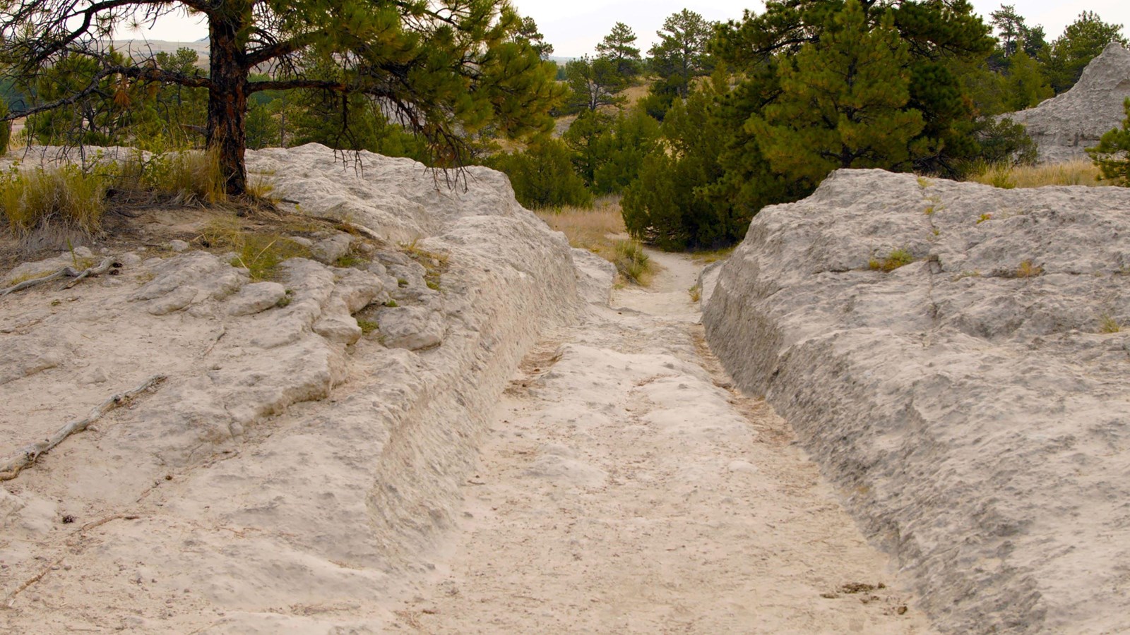
Guernsey Ruts
The most dramatic intact section of original trail. Hundreds of thousands of wagon wheels carved ruts up to 5 feet deep into the sandstone over just a few decades. A short walk from the town of Guernsey puts you directly in the tracks.
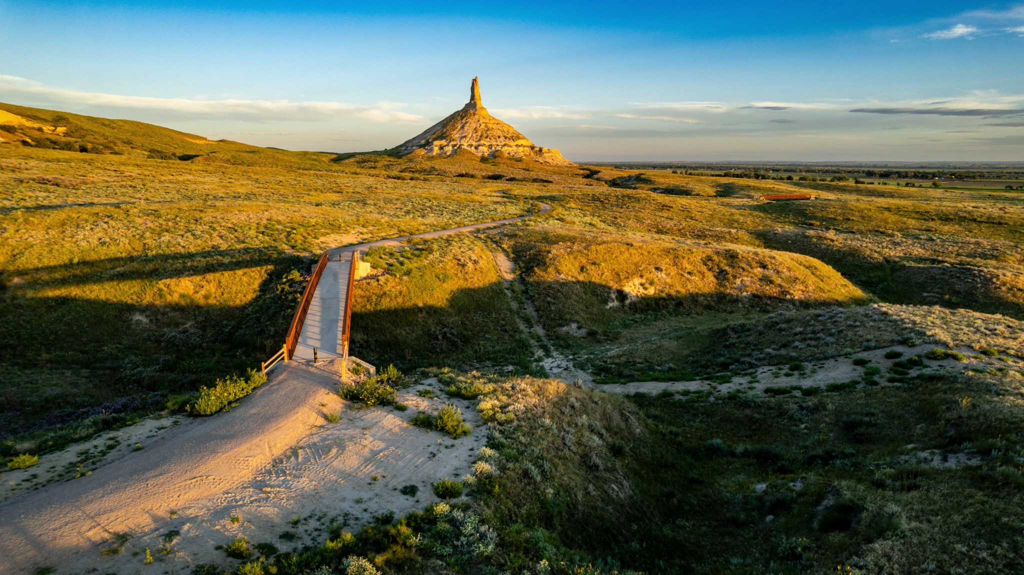
Chimney Rock & Scotts Bluff
Both are NPS Historic Sites and among the most instantly recognizable landmarks of the trail. Scotts Bluff has a visitor center with emigrant diary exhibits and a drive-through tunnel through the bluff itself, the same gap wagons used.
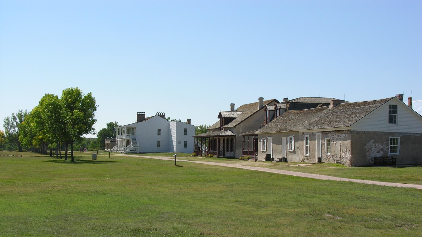
Fort Laramie NHS
One of the best-preserved 19th-century military forts in the country. Original adobe and frame buildings survive. Rangers in period dress interpret both the emigrant era and the later Indian Wars period. The fort bought for $4,000 in 1849 is now a national landmark.
Whitman Mission NHS
Near Walla Walla, Washington. The site of the 1847 massacre is preserved with a monument, a visitor center, and interpretive trails. Essential for understanding the trail’s Indigenous history and the events of November 1847.
End of the Oregon Trail Center
Oregon City, Oregon, the legal terminus. The interpretive center occupies the actual arrival point at Willamette Falls. Wagon-shaped buildings, living-history programs, and exhibits on what emigrants found when they finally arrived make this the most Oregon-specific site on the trail.
Independence Rock
A state historic site you can walk around freely. More than 125,000 emigrant names are carved or painted into the granite, you can still read them. Emigrants who reached the rock by July 4th knew they were on pace; those who arrived later worried about reaching the Cascades before snow.
Cultural legacy
The Oregon Trail video game and popular memory
The 1971 educational computer game The Oregon Trail, developed to teach Minnesota schoolchildren about pioneer history and later adapted for Apple II, introduced millions of Americans to the trail through simulated river crossings, broken axles, and the ever-present threat of dysentery. The game’s random-event model dramatizes danger (and underplays the reality that most emigrants survived). It also centers the emigrant experience on pioneer families, reflecting the historiography of its era. The actual trail is now a National Historic Trail managed by the National Park Service, with more than 300 identified historic landmarks and interpretive sites. The Oregon-California Trails Association (OCTA) maintains research resources, marks historic sites, and advocates for trail preservation.
11 Timeline & Legacy #
Key dates, and what the trail left behind.
Lewis & Clark Expedition
Lewis and Clark’s journals recorded topography, river conditions, and populous Indigenous landscapes along the Columbia system, making the region legible to U.S. readers and policymakers. They did not create the route, it already existed.
Robert Stuart identifies South Pass
Stuart’s eastbound crossing proved that wagons could cross the Continental Divide at a manageable elevation, the geographic discovery that made everything that followed possible.
U.S.–British joint occupation begins
The Convention of 1818 established joint occupation of the Oregon Country. Fort Nez Perces was established the same year with the consent of Walla Walla and Cayuse leaders.
Whitman and Spalding missionaries travel west
Narcissa Whitman and Eliza Spalding became the first Euro-American women to cross the Rocky Mountains on what became the Oregon Trail, transforming the fur route into a family migration precedent.
First emigrant wagon train departs Independence
~80 people under guide Thomas Fitzpatrick made the first organized wagon-train journey, establishing the corridor’s basic spine and beginning an era of annual emigration.
The Great Migration, 875 people, 100 wagons
Proved that large-scale household overland migration was feasible. By 1845, Americans outnumbered British residents in the Oregon Country for the first time.
Oregon Treaty signed; Barlow Road opens
The Oregon Treaty fixed the border at the 49th parallel. The Barlow Road opened the same year, giving wagon parties their first safe overland alternative to the Columbia River passage.
Whitman Massacre & the Cayuse War
Cayuse warriors killed Marcus and Narcissa Whitman and eleven others at the mission near Walla Walla. The attack triggered the Cayuse War and led directly to Congress organizing Oregon Territory in 1848.
Gold discovered at Sutter’s Mill; Oregon Territory organized
Two events that reshaped the trail simultaneously: gold in California began diverting enormous traffic southward from Fort Hall; Congress gave Oregon settlers a territorial government.
Donation Land Claim Act enacted
Federal land policy became the primary settlement incentive. The DLCA generated ~7,437 patents totaling over 2.5 million acres and brought a large wave of settlers into Oregon Territory.
Oregon arrivals peak at ~10,000
The highest single-year total for Oregon-specific arrivals. The broader corridor carried ~60,000 Oregon-and-California overlanders that year. The numerical high point of the emigrant era.
Treaty cessions and removal of Indigenous peoples
Treaty negotiations in 1854–1855 followed the land rush. The Yakama War and other conflicts followed.
Oregon admitted to the Union
On February 14, 1859, Valentine’s Day, Oregon became the 33rd state.
Transcontinental railroad completed
The completion of the railroad at Promontory Summit, Utah effectively ended the great emigrant-wagon era. A journey that took 4–6 months by wagon could now be made in days. Limited trail use persisted, but 1869 closes the defining chapter.
Art & Cultural Memory
Albert Bierstadt and the Romanticized West
Albert Bierstadt (1830–1902) was a German-American landscape painter who became one of the most celebrated artists of the American West. He traveled along the Oregon Trail corridor in the 1850s and 1860s, filling sketchbooks with studies of light, clouds, and the sweep of the Great Plains and Rocky Mountains. His finished canvases, often enormous and intensely luminous, became the defining visual record of westward expansion for millions of Americans who would never see the West themselves.
His painting The Oregon Trail (1869) is among the most recognized images in American art history: a late-afternoon sun dissolving into a golden haze, covered wagons threading through tall grass toward a distant horizon. Bierstadt’s work both documented and romanticized the trail, emphasizing grandeur and light while eliding its dangers, its death toll, and the displacement of peoples who had long lived in those landscapes. That vision shaped how Americans remembered the emigrant era, and that romanticized memory shaped history itself.


Legacy & historiography
The trail in historical memory
Commemorative memory long celebrated the Oregon Trail as a heroic road of pioneer families, a narrative still present in museums, monuments, state license plates, and organizations like the Oregon-California Trails Association. That story is not false, exactly. The families were real, the hardship was real, and the achievement of crossing 2,000 miles by wagon was genuinely extraordinary.
But modern historiography has fundamentally expanded what the trail means. The “Whitman saved Oregon” myth, the claim that Marcus Whitman’s 1842–43 ride east personally secured Oregon for the United States, was being dismantled as early as the 1880s by Oregon historian Frances Fuller Victor, who argued correctly that it was fiction. The 1843 migration and geopolitical pressure from British competition are the better explanations. More broadly, the strongest current scholarship treats the Oregon Trail as simultaneously a family migration, a transportation corridor, a policy instrument, a business ecosystem, and a driver of U.S. territorial expansion. The trail made Oregon. Understanding how fully requires holding both the pioneer story and the broader history of what the trail set in motion.
❓ 12 Frequently Asked Questions
The Oregon Trail was a 2,000-mile overland emigrant route from jumping-off points near the Missouri River to the Willamette Valley in Oregon. Used primarily between 1840 and 1869, it carried an estimated 300,000 to 500,000 people westward and was the largest land migration in American history. It was not a single paved road but a broad corridor of wheel ruts, river crossings, and alternate cutoffs that followed ancient Indigenous travel networks across six present-day states.
The trail began at jumping-off points on the Missouri River, most famously Independence, Missouri, though St. Joseph and Westport (present-day Kansas City) were also used. It ended at Oregon City, at Willamette Falls in present-day Clackamas County, Oregon, the first incorporated city west of the Rocky Mountains. The total distance was approximately 2,000 to 2,170 miles depending on route variations.
The Oregon Trail was approximately 2,000 to 2,170 miles long. The segment from Fort Hall in present-day Idaho to Oregon City alone was about 800 miles. Traveling the full route took between four and six months, averaging about 12–15 miles per day in the 1840s, improving to about 128 days average in the 1850s as route knowledge and cutoffs improved.
Estimates vary depending on what is counted. John D. Unruh Jr.’s reconstruction, reproduced in NPS scholarship, yields 53,062 overland arrivals specifically to Oregon between 1840 and 1860. For the broader corridor shared with California- and Utah-bound travelers, NPS materials place total trail use from 1840 to 1869 above 500,000 people.
The Oregon-specific peak was 1852, when an estimated 10,000 people arrived in Oregon, driven by the Donation Land Claim Act of 1850. Migration declined sharply after 1854 and effectively ended with the completion of the transcontinental railroad in 1869.
Disease, especially cholera, was the principal killer, not Native attack. Estimates suggest 4–6 percent of overlanders died between 1840 and 1860. Accidents were the second leading cause. John D. Unruh Jr.’s tabulation of recorded Native-emigrant conflict deaths for 1840–1860 yields 362 emigrants killed, a small fraction of total mortality. Violence did intensify in certain corridors after 1849, but disease and accidents far outpaced it.
The Great Migration of 1843 was a wagon train of approximately 875 men, women, and children, with about 100 wagons and 700 head of cattle. It was the first large-scale organized household migration to Oregon and proved that the overland route was feasible for families, not just fur traders. Its success triggered rapid escalation through the rest of the 1840s.
Manifest Destiny was the widespread 19th-century American belief that U.S. expansion westward across the continent to the Pacific Ocean was both inevitable and divinely ordained. The concept was popularized in the 1840s and provided the ideological framework for migration, territorial acquisition, and the displacement of Indigenous peoples. It was used by politicians, journalists, and missionaries to frame westward movement as patriotic duty as much as personal opportunity.
In November 1847, Cayuse warriors killed Marcus and Narcissa Whitman and eleven others at the Whitman Mission near present-day Walla Walla, Washington. The attack was rooted in years of accumulated Cayuse grievance, the mission attracted emigrants, served as a vector for measles epidemics that killed Cayuse disproportionately, and symbolized accelerating land occupation. It triggered the Cayuse War and led directly to Congress organizing Oregon as a U.S. Territory in August 1848.
The Donation Land Claim Act of 1850 offered free land grants to settlers in Oregon. Single qualified settlers received 320 acres; married couples received 640 acres, with half in the wife’s own right. It generated roughly 7,437 patents totaling more than 2.5 million acres and was the primary driver of the early 1850s migration surge.
The Barlow Road was a one-way toll road opened in 1846 that gave wagon parties an overland alternative to the hazardous Columbia River passage from The Dalles to Oregon City. Financed by Philip Foster and led by Sam Barlow, it carried an estimated 31,000+ overlanders during peak migration years. About two-thirds of emigrants chose it over the river route after 1846.
Yes. About 300 miles of original wheel ruts remain visible across the route. The most dramatic example is at Guernsey, Wyoming, where ruts are carved up to 5 feet deep into sandstone bedrock. Other well-preserved sections exist in Nebraska and Idaho. Key NPS sites include Scotts Bluff National Monument (NE), Fort Laramie National Historic Site (WY), Independence Rock (WY), Whitman Mission National Historic Site (WA), and the End of the Oregon Trail Interpretive Center in Oregon City, OR. The Oregon Trail is a federally designated National Historic Trail managed by the National Park Service.
Sources & Further Reading #
Primary records, NPS scholarship, and key secondary works.
📋 Cite this page
Recommended Books #
Vetted picks for every level of interest, from gripping narratives to essential primary sources.
📚 4 Essential Modern Reads
Best overall · Narrative nonfiction
The Oregon Trail: A New American Journey
Buck and his brother drove the 2,000-mile trail in a mule-drawn covered wagon, the first time in a century anyone had done so. Part memoir, part history, part road-trip comedy, it’s the most readable introduction to the trail available, packed with genuine historical depth. #1 New York Times bestseller.
Buy on AmazonEssential background · Lewis & Clark
Undaunted Courage
The definitive account of the Lewis and Clark expedition, the journey that made the Oregon Trail possible. Reads like an adventure novel, with Jefferson, Clark, Sacagawea, and Lewis himself fully rendered as human beings. Start here before any other trail reading.
Buy on AmazonWomen’s history · Primary voices
Women’s Diaries of the Westward Journey
Schlissel compiled the actual trail diaries of women who made the crossing, campfire cooking on buffalo chips, births in covered wagons, river crossings, loss. An essential corrective to the male-dominated trail narrative, and a more intimate window into daily life than any secondary account can provide.
Buy on AmazonPrimary source · Eyewitness 1846
The Oregon Trail: Sketches of Prairie and Rocky-Mountain Life
Parkman traveled part of the trail himself in 1846 and wrote the original eyewitness classic. Vivid, opinionated, and bracingly alive, it remains the best firsthand narrative of the trail corridor. Note: Parkman’s views on Indigenous peoples reflect 19th-century attitudes, read critically alongside modern scholarship.
Buy on Amazon🗂️ 5 Historical Primary Sources
Public domain works available as inexpensive reprints. Most are also free on Project Gutenberg.
Fur trade · Columbia River · 1831
Adventures on the Columbia River
Cox spent six years as a Pacific Fur Company trader on the Columbia, one of the sharpest firsthand accounts of the fur-trade era that made the trail possible.
Buy on AmazonPacific Northwest · Travel · 1862
The Canoe and the Saddle
Winthrop’s 1853 journey through Oregon and Washington wilderness, rivers, forests, and mountains described with a novelist’s eye. A Pacific Northwest classic.
Find on AmazonIndigenous history · Yakama · 1917
Ka-mi-akin: The Last Hero of the Yakimas
The biography of Kamiakin, the Yakama leader who resisted settlement encroachment. An important counterweight to emigrant-centered narratives.
Find on AmazonEmigrant account · 1843 migration · 1904
Overland to Oregon in the Tracks of Lewis and Clarke
A reconstruction of the 1843 Great Migration drawing on firsthand emigrant accounts, one of the closest views available of that pivotal first wagon train.
Find on AmazonMissions · Whitman · 1895
The Story of Marcus Whitman
Contemporary account of Whitman’s missionary work and the 1847 massacre, a key turning point in the relationship between settlers and Indigenous peoples along the trail corridor.
Find on Amazon