Oregon Tails — Oregon Guide
The Oregon Guide
Everything you want to know about one of the most geographically varied states in the country. From the Pacific Coast to the high desert, here is where to start.
(9th Largest State)
Public Coastline
and Recreation Areas
(Deepest in the US)
One of the most geographically varied states in the country
Oregon sits at the western edge of the continent, and the landscape refuses to be summarized. Drive four hours from the coast and you will move through old-growth temperate rainforest, up over a volcanic mountain range, and down into a high desert that gets less than 10 inches of rain a year. The state has more than 250 state parks, 11 national forests, and a Pacific coastline that is entirely public land by state law.
This guide covers Oregon from the ground up. Whether you want to understand the history that brought settlers across 2,000 miles of prairie, learn why the state flag has two sides, or simply figure out the best time to visit, you are in the right place.
Oregon’s 1967 Beach Bill declared the entire Pacific shoreline a public highway. Every inch of the coast is legally accessible to anyone, from Brookings to Astoria.
No two parts of Oregon feel alike. The wet western valleys, the volcanic Cascades, the dry central plateau, and the remote eastern desert each operate on their own climate and rhythm.
Skiing on Mt. Hood runs into June. Whale watching peaks in December and March. Wildflower season in the Gorge starts in March. Oregon rewards visitors in every month of the year.
Over 400,000 emigrants traveled the Oregon Trail to reach the Willamette Valley. Oregon became the 33rd state in 1859, and its history reaches back more than 15,000 years before that.
Everything you need to know about Oregon
Start with any guide below. Each one goes deep on a single topic.
 Fun Facts
Oregon Fun Facts
Oregon is the only US state with a two-sided flag. Crater Lake is the deepest in the country. The entire coast is public land. These are the facts about Oregon that most people do not know. We have collected the best of them.
Read the guide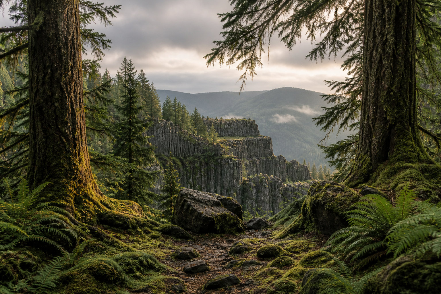 History
Oregon Trail History
More than 400,000 people made the 2,170-mile journey west between 1843 and 1869. Here is the full story of who traveled the trail, why they came, and what Oregon looked like when they arrived.
Read the guide Geography
Oregon Regions
Oregon has six distinct geographic regions, each with its own climate, terrain, and character. Coast, Willamette Valley, Cascades, Central Oregon, Southern Oregon, and Eastern Oregon, all covered here.
Read the guide Seasonal Guide
Best Time to Visit Oregon
Month-by-month breakdown of Oregon’s weather, crowd levels, and what each season is actually best for. The answer depends on where you are going and what you want to do.
Read the guide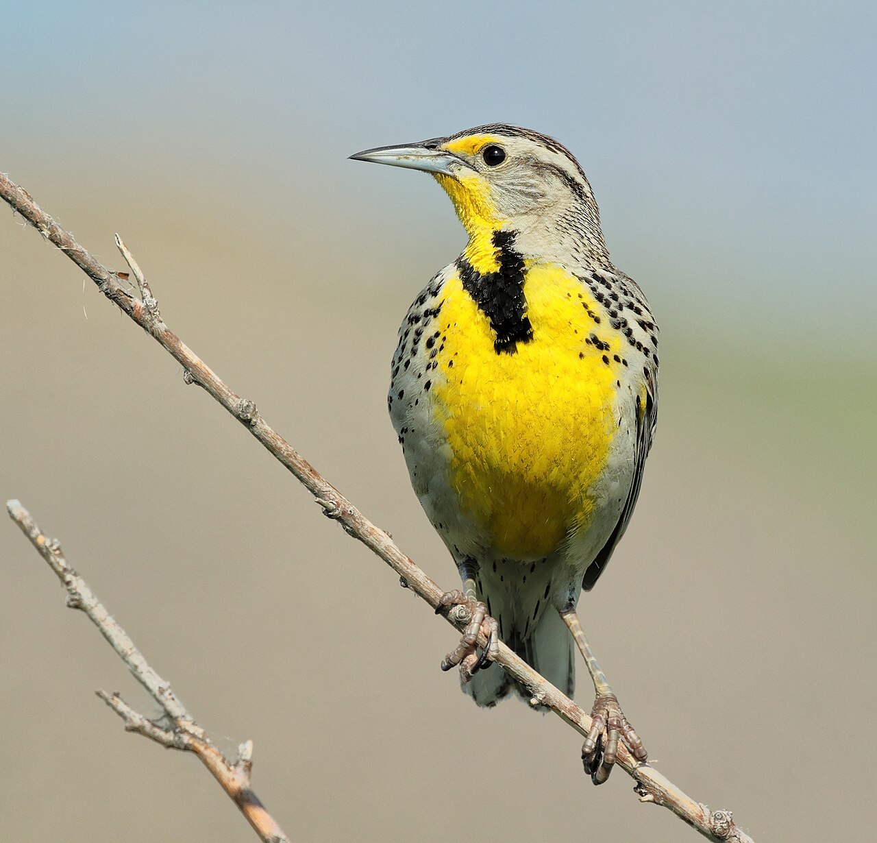 State Symbols
Oregon State Symbols
The western meadowlark, the Douglas fir, the Oregon grape, the Chinook salmon. Every official state symbol, with the story of why each one was chosen.
Read the guide Geography
Oregon Geography
How Oregon’s mountains, rivers, volcanoes, and valleys were formed. The Cascades, the Columbia, the Coast Range, the high desert, and what drives the dramatic west-to-east climate shift.
Read the guideExplore Oregon by region
Each region has a different feel. Start with the one that matches what you are looking for.
Oregon Coast
363 miles of public beaches, sea stacks, and tide pools. Fully public by state law.
Willamette Valley
Oregon’s most populated corridor. Wineries, waterfalls, and the western terminus of the Oregon Trail.
The Cascades
A chain of volcanic peaks from Mt. Hood to Crater Lake. Year-round skiing, alpine lakes, and lava fields.
Central Oregon
Bend is the hub. High desert terrain, world-class rock climbing at Smith Rock, and 300 days of sun.
Southern Oregon
Crater Lake, the Rogue River, and a warmer, drier climate than the rest of western Oregon.
Eastern Oregon
Remote high desert, the Painted Hills, Steens Mountain, and more dark sky than anywhere in the state.
Ready to get outside?
From day hikes on the coast to multi-day backpacking routes in the Cascades, the activities guides cover where to go and what to bring.
Oregon guide: frequently asked questions
Quick answers to the most common Oregon questions.
What is Oregon best known for?
Oregon is best known for its dramatic Pacific coastline, which is entirely public land, and Crater Lake, the deepest lake in the United States at 1,943 feet. The state is also known for the Columbia River Gorge and Multnomah Falls, the Cascades volcanic range, and as the western destination of the Oregon Trail. Portland is a major draw for food, craft beer, and culture, and Bend has become one of the top outdoor recreation cities in the country.
Is Oregon worth visiting?
Oregon ranks among the most geographically varied states in the country. In a single trip you can stand on a fully public Pacific beach, drive through temperate rainforest, hike on a glacier-covered volcano, and reach a high desert with near-zero light pollution. The state has 254 state parks, more covered bridges than anywhere west of the Mississippi, and a year-round outdoor calendar. Summer is crowded and dry. Fall is quieter, with clear skies and changing foliage. The coast and the Cascades are both stunning in spring.
What is the Oregon Trail?
The Oregon Trail was a roughly 2,170-mile overland emigrant route used from the early 1840s through the 1860s. Settlers departed from Independence, Missouri and traveled across the Great Plains, the Rocky Mountains, and the Blue Mountains of northeastern Oregon before descending into the Willamette Valley. More than 400,000 people made the journey during the peak emigration years. The route could take four to six months on foot or by wagon. Oregon City, just south of Portland, was the official end of the trail.
How big is Oregon?
Oregon covers 98,379 square miles, making it the 9th largest state in the country. It measures roughly 395 miles north to south and 400 miles east to west. The population is approximately 4.2 million, concentrated in the Willamette Valley. Portland is the largest city with about 650,000 residents. Most of eastern Oregon is sparsely populated high desert, and several counties have fewer than 2 people per square mile.
What are some unique facts about Oregon?
Oregon is the only US state with a two-sided state flag. One side shows the state seal; the other shows a beaver. Crater Lake is the deepest lake in the United States and the ninth deepest in the world. The entire Oregon coastline is legally public land under a 1967 law, so there are no private beaches. Oregon has more ghost towns than any other state. And the Painted Hills in Wheeler County are among the most photographed geological formations in the Pacific Northwest.